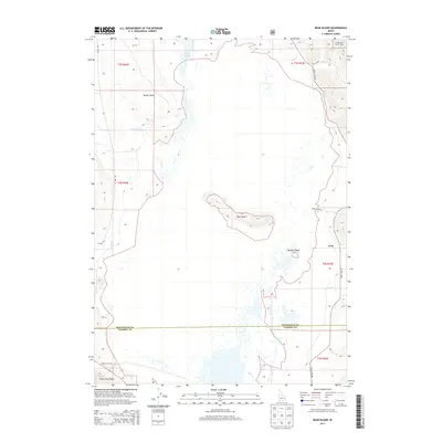
2013 Map of Bear Island
USGS Topo · Published 2013About this map
Grays Lake dominates the central portion of this 2013 topographic study, illustrating the unique wetland and aquatic environment along the border of Bonneville and Caribou counties. The settlement of Gray sits on the eastern edge of this expansive basin, which is punctuated by prominent landforms rising from the water, most notably Bear Island and the smaller Bishop Island. These interior heights provide a distinct contrast to the surrounding marshy lowlands and the seasonal drainages that feed them, such as Willow Cr and Bridge Cr.
Find a feature on this map
23 named features on this map. Tap any name to fly to it.
Don’t see what you’re looking for? This feature index may not catch every label — zoom into the map to look around manually.
Map Details
Editions of this 2013 Bear Island Map
This is the sole edition of this map. No revisions or reprints were ever made.
Other maps of this area

1914 · Henry
USGS Topo · 1:48,000

1915 · Lanes Creek
USGS Topo · 1:62,500

1916 · Henry
USGS Topo · 1:62,500

1917 · Cranes Flat
USGS Topo · 1:62,500

1932 · Irwin
USGS Topo · 1:96,000

1935 · Irwin
USGS Topo · 1:125,000

1955 · Driggs
USGS Topo · 1:250,000

1955 · Preston
USGS Topo · 1:250,000

1958 · Driggs
USGS Topo · 1:250,000

1958 · Preston
USGS Topo · 1:250,000