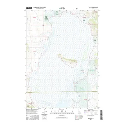
2017 Map of Bear Island
USGS Topo · Published 2017About this map
Grays Lake National Wildlife Refuge dominates this section of the high mountain basin, encompassing the vast wetlands and waters of Grays Lake. The terrain is characterized by the flat marshlands of the lakebed, interrupted by distinctive rises such as Bear Island and Bishop Island. Near the eastern boundary, the settlement of Gray sits at the edge of the refuge, while the southern reaches show the small locality of Clarks Cut near Little Gray Ridge. The map illustrates a complex water system including Little Valley Creek and Outlet Valley, where drainage patterns define the valley floor. Transportation is limited to rural routes like Willow Creek Rd and Grays Lk Rd, which skirt the protected lands of the Caribou National Forest and the refuge boundaries.
Find a feature on this map
27 named features on this map. Tap any name to fly to it.
Don’t see what you’re looking for? This feature index may not catch every label — zoom into the map to look around manually.
Map Details
Editions of this 2017 Bear Island Map
This is the sole edition of this map. No revisions or reprints were ever made.
Other maps of this area

1914 · Henry
USGS Topo · 1:48,000

1915 · Lanes Creek
USGS Topo · 1:62,500

1916 · Henry
USGS Topo · 1:62,500

1917 · Cranes Flat
USGS Topo · 1:62,500

1932 · Irwin
USGS Topo · 1:96,000

1935 · Irwin
USGS Topo · 1:125,000

1955 · Driggs
USGS Topo · 1:250,000

1955 · Preston
USGS Topo · 1:250,000

1958 · Driggs
USGS Topo · 1:250,000

1958 · Preston
USGS Topo · 1:250,000