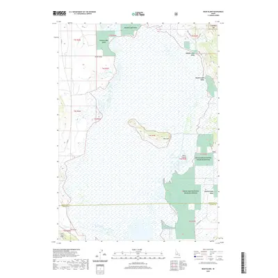
2020 Map of Bear Island
USGS Topo · Published 2020About this map
Grays Lake dominates this high-altitude wetlands landscape, serving as a central catchment for numerous seasonal drainages. The marshy basin is protected as the Grays Lake National Wildlife Refuge and Grays Lake NWR, providing critical habitat within the larger Caribou NF system. Topographic relief is provided by several distinct landforms that rise above the water level, including Bear Island and Bishop Island, along with the Little Gray Ridge to the southwest.
Find a feature on this map
25 named features on this map. Tap any name to fly to it.
Don’t see what you’re looking for? This feature index may not catch every label — zoom into the map to look around manually.
Map Details
Editions of this 2020 Bear Island Map
This is the sole edition of this map. No revisions or reprints were ever made.
Other maps of this area

1914 · Henry
USGS Topo · 1:48,000

1915 · Lanes Creek
USGS Topo · 1:62,500

1916 · Henry
USGS Topo · 1:62,500

1917 · Cranes Flat
USGS Topo · 1:62,500

1932 · Irwin
USGS Topo · 1:96,000

1935 · Irwin
USGS Topo · 1:125,000

1955 · Driggs
USGS Topo · 1:250,000

1955 · Preston
USGS Topo · 1:250,000

1958 · Driggs
USGS Topo · 1:250,000

1958 · Preston
USGS Topo · 1:250,000