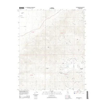
2015 Map of Bear Mountain
USGS Topo · Published 2015About this map
The Sierra Nevada meets the southern San Joaquin Valley in this detailed survey of the rugged transition into the Tehachapi Mountains. High-altitude terrain is dominated by the massive profile of Bear Mountain, falling away into the deep drainage of Little Sycamore Canyon. The landscape shows the distinct footprint of modern residential planning at Bear Valley Springs, where a dense network of local roads like Bear Valley Road and Cumberland Road winds through the elevated topography. This development contrasts sharply with the open, undeveloped stretches of Horsethief Flat and Oak Flat. The map provides an intricate view of how 21st-century settlement patterns have adapted to the steep slopes of the Central Valley rim, preserving seasonal watercourses such as Clear Creek and Teal Creek within a residential context.
Find a feature on this map
55 named features on this map. Tap any name to fly to it.
Don’t see what you’re looking for? This feature index may not catch every label — zoom into the map to look around manually.
Map Details
Editions of this 2015 Bear Mountain Map
This is the sole edition of this map. No revisions or reprints were ever made.
Other maps of this area

1914 · Caliente
USGS Topo · 1:125,000

1929 · Bena
USGS Topo · 1:31,680

1930 · Bear Mountain
USGS Topo · 1:31,680

1930 · Arvin
USGS Topo · 1:31,680

1931 · Edison
USGS Topo · 1:31,680

1931 · Tejon Hills
USGS Topo · 1:31,680

1932 · Bena
USGS Topo · 1:31,680

1933 · Arvin
USGS Topo · 1:31,680

1933 · Tejon Hills
USGS Topo · 1:31,680

1933 · Bear Mountain
USGS Topo · 1:31,680