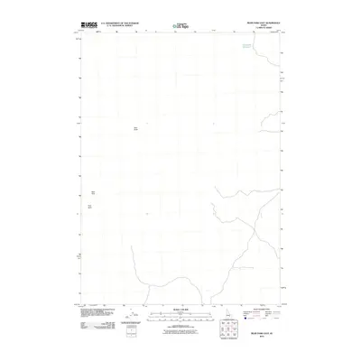
2010 Map of Bear Park East
USGS Topo · Published 2010About this map
Bear Park and the high desert terrain of southern Idaho define this 2010 USGS topographic survey. The landscape is characterized by its volcanic and arid features, most notably the prominent rises of New Butte and Park Butte. These landmarks serve as critical orientation points in a region with sparse water resources. The most significant hydrologic feature is Deadhorse Reservoir, situated in the northeastern portion of the quadrangle. The map documents the primitive road network and 4WD tracks that crisscross this open range, illustrating how the land is accessed for ranching and recreation in the modern era. While settlement is absent, the naming of these specific buttes and the reservoir reflects the enduring local identifiers used by those who navigate this portion of the Snake River Plain.
Find a feature on this map
4 named features on this map. Tap any name to fly to it.
Don’t see what you’re looking for? This feature index may not catch every label — zoom into the map to look around manually.
Map Details
Editions of this 2010 Bear Park East Map
This is the sole edition of this map. No revisions or reprints were ever made.
Other maps of this area

1955 · Idaho Falls
USGS Topo · 1:250,000

1958 · Idaho Falls
USGS Topo · 1:250,000

1972 · Antelope Lake
USGS Topo · 1:24,000

1972 · Mule Butte
USGS Topo · 1:24,000

1972 · Pratt Butte
USGS Topo · 1:24,000

1972 · Bear Park SW
USGS Topo · 1:24,000

1972 · Mosby Butte
USGS Topo · 1:24,000

1972 · Bear Park East
USGS Topo · 1:24,000

1972 · Bear Park West
USGS Topo · 1:24,000

1972 · Serviceberry Butte
USGS Topo · 1:24,000