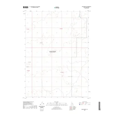
2020 Map of Bear Park East
USGS Topo · Published 2020About this map
Craters of the Moon National Preserve dominates this high-desert landscape in Blaine County, documenting a geologic environment shaped by volcanic activity. The map traces the southern progression of the Great Rift, a massive fracture in the earth's crust that defines the structural character of this region. This 2020 survey captures the stark isolation of the lava fields, where topographic relief is provided by volcanic features such as New Butte and Park Butte. While much of the terrain is defined by these basaltic formations, the presence of the Deadhorse Reservoir in the northeast corner and the open expanse of Bear Park provide critical reference points for understanding the rare water sources and traditional grazing areas utilized within this arid volcanic corridor.
Find a feature on this map
10 named features on this map. Tap any name to fly to it.
Don’t see what you’re looking for? This feature index may not catch every label — zoom into the map to look around manually.
Map Details
Editions of this 2020 Bear Park East Map
This is the sole edition of this map. No revisions or reprints were ever made.
Other maps of this area

1955 · Idaho Falls
USGS Topo · 1:250,000

1958 · Idaho Falls
USGS Topo · 1:250,000

1972 · Antelope Lake
USGS Topo · 1:24,000

1972 · Mule Butte
USGS Topo · 1:24,000

1972 · Pratt Butte
USGS Topo · 1:24,000

1972 · Bear Park SW
USGS Topo · 1:24,000

1972 · Mosby Butte
USGS Topo · 1:24,000

1972 · Bear Park East
USGS Topo · 1:24,000

1972 · Bear Park West
USGS Topo · 1:24,000

1972 · Serviceberry Butte
USGS Topo · 1:24,000