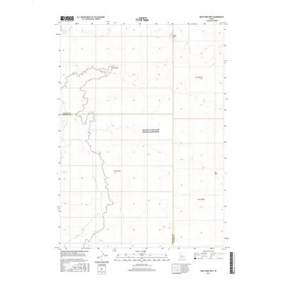
2017 Map of Bear Park West
USGS Topo · Published 2017About this map
Craters of the Moon National Monument dominates the central and southern portions of this landscape, marking a stark transition between the volcanic terrain and the surrounding high desert. The boundary between Blaine and Minidoka counties cuts horizontally across the sheet, dividing a region defined more by its geological features than by human settlement. Water is a sparse but vital presence in this arid environment, evidenced by the small catchment at Gerity Reservoir in the northwest and Bear Den Lake further south. To the east, the terrain rises toward Coyote Butte and the namesake Bear Park, providing a sense of the varied elevations found within the Snake River Plain. The map's township and range lines, such as t2s r25e, frame a wilderness area where natural landmarks and administrative borders are the primary points of orientation.
Find a feature on this map
11 named features on this map. Tap any name to fly to it.
Don’t see what you’re looking for? This feature index may not catch every label — zoom into the map to look around manually.
Map Details
Editions of this 2017 Bear Park West Map
This is the sole edition of this map. No revisions or reprints were ever made.
Other maps of this area

1955 · Idaho Falls
USGS Topo · 1:250,000

1958 · Idaho Falls
USGS Topo · 1:250,000

1972 · North Laidlaw Butte
USGS Topo · 1:24,000

1972 · Mule Butte
USGS Topo · 1:24,000

1972 · Pratt Butte
USGS Topo · 1:24,000

1972 · Bear Park SW
USGS Topo · 1:24,000

1972 · Bear Den Butte
USGS Topo · 1:24,000

1972 · Bear Park East
USGS Topo · 1:24,000

1972 · Bottleneck Lake
USGS Topo · 1:24,000

1972 · Bear Park West
USGS Topo · 1:24,000