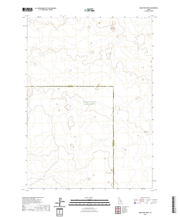
2023 Map of Bear Park West
USGS Topo · Published 2023About this map
Craters Of The Moon National Preserve dominates the southern half of this landscape, marking a terrain defined by volcanic history along the border of Blaine and Minidoka counties. The map captures the stark geological character of the Great Rift, which cuts across the northeastern sections of the quadrangle. In this environment, specific landmarks like Coyote Butte and Bear Park provide the only named reference points in an area largely shaped by vast lava flows and the Public Land Survey System grids of Township 2 South and Township 3 South. The lack of conventional roads or settlements emphasizes the specialized nature of this protected high-desert environment, where elevation contours and geological features are the primary indicators of place.
Find a feature on this map
10 named features on this map. Tap any name to fly to it.
Don’t see what you’re looking for? This feature index may not catch every label — zoom into the map to look around manually.
Map Details
Editions of this 2023 Bear Park West Map
This is the sole edition of this map. No revisions or reprints were ever made.
Other maps of this area

1955 · Idaho Falls
USGS Topo · 1:250,000

1958 · Idaho Falls
USGS Topo · 1:250,000

1972 · North Laidlaw Butte
USGS Topo · 1:24,000

1972 · Mule Butte
USGS Topo · 1:24,000

1972 · Pratt Butte
USGS Topo · 1:24,000

1972 · Bear Park SW
USGS Topo · 1:24,000

1972 · Bear Den Butte
USGS Topo · 1:24,000

1972 · Bear Park East
USGS Topo · 1:24,000

1972 · Bottleneck Lake
USGS Topo · 1:24,000

1972 · Bear Park West
USGS Topo · 1:24,000