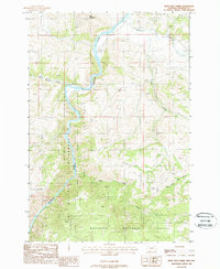
1988 Map of Bear Trap Creek
USGS Topo · Published 1988About this map
The Madison River carves a deep path through this Montana landscape, defining the western edge of the Lee Metcalf Wilderness and the Gallatin National Forest. The 1988 topography captures the transition from the Madison Plateau down to the riverbanks, where tributary systems like Hot Springs Creek and Cherry Creek feed into the main channel. Evidence of small-scale mountain industry is scattered throughout the drainages, with several Prospects and Mine Shafts marked near the river and its smaller branches. This provisional survey highlights the intersection of public land preservation and legacy mining activity, anchored by prominent peaks like Red Mountain. To the east, the terrain rises toward the Savannah, while the Madison River remains the central artery for both recreation, indicated by a riverside Campground, and the local drainage network including Bear Trap Creek and Pole Creek.
Find a feature on this map
17 named features on this map. Tap any name to fly to it.
Don’t see what you’re looking for? This feature index may not catch every label — zoom into the map to look around manually.
Map Details
Editions of this 1988 Bear Trap Creek Map
This is the sole edition of this map. No revisions or reprints were ever made.
Other maps of this area

1888 · Three Forks
USGS Topo · 1:250,000

1894 · Three Forks
USGS Topo · 1:250,000

1895 · Three Forks
USGS Topo · 1:250,000

1947 · Bozeman
USGS Topo · 1:250,000

1948 · Bozeman
USGS Topo · 1:250,000

1949 · Anceney
USGS Topo · 1:62,500

1949 · Ennis
USGS Topo · 1:62,500

1949 · Norris
USGS Topo · 1:62,500

1950 · Spanish Peaks
USGS Topo · 1:62,500

1951 · Norris
USGS Topo · 1:62,500