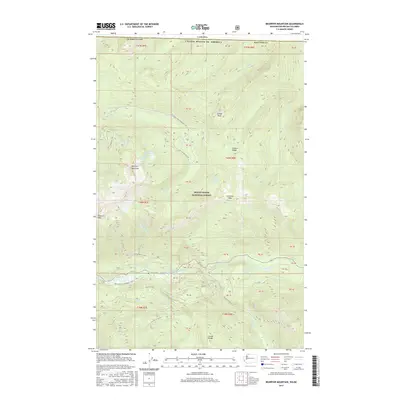
2017 Map of Bearpaw Mountain
USGS Topo · Published 2017About this map
Bearpaw Mountain and the high ridges of the Mount Baker National Forest dominate this 2017 survey of the Whatcom County high country along the Canadian border. The landscape is defined by the drainage of the North Fork Nooksack River, which is fed by numerous alpine tributaries including Deadhorse Cr, Whistler Cr, and Canyon Cr. These glacial waters flow past landmarks like Cascade Falls and through a network of peaks including Church Mtn and Cowap Peak.
Find a feature on this map
40 named features on this map. Tap any name to fly to it.
Don’t see what you’re looking for? This feature index may not catch every label — zoom into the map to look around manually.
Map Details
Editions of this 2017 Bearpaw Mountain Map
This is the sole edition of this map. No revisions or reprints were ever made.
Other maps of this area

1909 · Mt Baker
USGS Topo · 1:192,000

1915 · Mt. Baker
USGS Topo · 1:250,000

1952 · Mt. Baker
USGS Topo · 1:62,500

1953 · Mt Shuksan
USGS Topo · 1:62,500

1955 · Concrete
USGS Topo · 1:250,000

1958 · Concrete
USGS Topo · 1:250,000

1962 · Concrete
USGS Topo · 1:250,000

1979 · Mt. Baker
USGS Topo · 1:100,000
1989 · Shuksan Arm
USGS Topo · 1:24,000
1989 · Groat Mountain
USGS Topo · 1:24,000