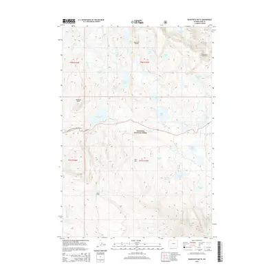
2015 Map of Beartooth Butte
USGS Topo · Published 2015About this map
Beartooth National Scenic Byway winds through the high-elevation terrain of the Shoshone National Forest, providing the primary corridor across this alpine landscape. The map centers on the prominent Beartooth Butte, a distinct geological landmark rising above the waters of Beartooth Lake and the cascading Beartooth Falls. This area is characterized by the expansive Beartooth Plateau and the rugged Beartooth Mountains, where drainage systems like Beartooth Cr and Little Bear Cr connect a dense network of glacial lakes. Notable water bodies include Island Lake, Beauty Lake, and the remote Native Lake in the northwest. To the south, the topography is defined by the high elevations of Bird Mtn and Table Mtn, illustrating the high-altitude wilderness typical of the Wyoming high country in the early twenty-first century. The presence of numerous named tarns, such as the Chain Lakes and Emerald Lake, highlights the complex hydrology of the subalpine basins.
Find a feature on this map
40 named features on this map. Tap any name to fly to it.
Don’t see what you’re looking for? This feature index may not catch every label — zoom into the map to look around manually.
Map Details
Editions of this 2015 Beartooth Butte Map
This is the sole edition of this map. No revisions or reprints were ever made.
Other maps of this area

1896 · Crandall Creek
USGS Topo · 1:125,000

1898 · Granite Mountain District
USGS Topo · 1:125,000

1899 · Crandall
USGS Topo · 1:125,000

1950 · Deep Lake
USGS Topo · 1:62,500

1954 · Billings
USGS Topo · 1:250,000

1955 · Cody
USGS Topo · 1:250,000

1956 · Alpine
USGS Topo · 1:62,500

1956 · Mount Maurice
USGS Topo · 1:62,500

1956 · Beartooth Butte
USGS Topo · 1:62,500

1957 · Billings
USGS Topo · 1:250,000