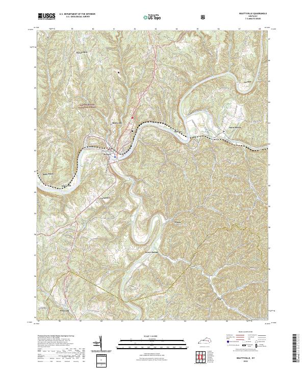
2022 Map of Beattyville
USGS Topo · Published 2022About this map
The confluence of the North Fork Kentucky River, Middle Fork Kentucky River, and South Fork Kentucky River defines the landscape of Lee County. This 2022 survey documents the county seat at Beattyville, where the Lee County Courthouse stands near the northern bank of the main Kentucky River. The map captures the distinct settlement pattern of the Kentucky River Palisades and the Daniel Boone National Forest, with homes and communities like Proctor and Maloney following the winding valley floor and ridgelines like Maloney Ridge Rd.
Find a feature on this map
97 named features on this map. Tap any name to fly to it.
Don’t see what you’re looking for? This feature index may not catch every label — zoom into the map to look around manually.
Map Details
Editions of this 2022 Beattyville Map
This is the sole edition of this map. No revisions or reprints were ever made.
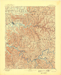
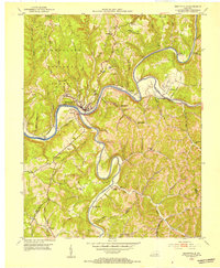
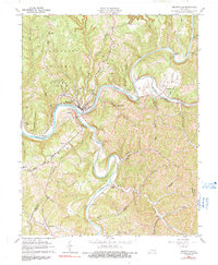
Historical Maps of Mount Olive Through Time
4 maps found