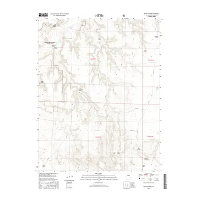
2016 Map of Beaty Canyon
USGS Topo · Published 2016About this map
The Purgatoire River carves through the landscape of the Comanche National Grassland, defining the drainage patterns and rugged geography of this southeastern Colorado region. The map reveals a complex network of canyons branching away from the main river corridor, including Beaty Canyon, Purgatoire Canyon, and Rourke Canyon. Distinctive landforms such as Picture Window Rock and Piñon Park Hill provide orientation points across the high desert terrain. Water sources are scarce but critical, marked by isolated points like Goat Ranch Spring, Sumpter Spring, and Fritz Spring, which likely served as vital hubs for early cattle ranching and modern land management in this arid environment. Roads like Co RD 177.9 follow the natural topography, connecting the plateaus above the canyon floors.
Find a feature on this map
28 named features on this map. Tap any name to fly to it.
Don’t see what you’re looking for? This feature index may not catch every label — zoom into the map to look around manually.
Map Details
Editions of this 2016 Beaty Canyon Map
This is the sole edition of this map. No revisions or reprints were ever made.
Other maps of this area

1891 · Higbee
USGS Topo · 1:125,000

1891 · Timpas
USGS Topo · 1:125,000

1891 · Mesa De Maya
USGS Topo · 1:125,000

1892 · Mt Carrizo
USGS Topo · 1:125,000

1893 · Higbee
USGS Topo · 1:125,000

1893 · Mesa de Maya
USGS Topo · 1:125,000

1894 · Timpas
USGS Topo · 1:125,000

1955 · La Junta
USGS Topo · 1:250,000

1958 · La Junta
USGS Topo · 1:250,000

1968 · La Junta
USGS Topo · 1:250,000