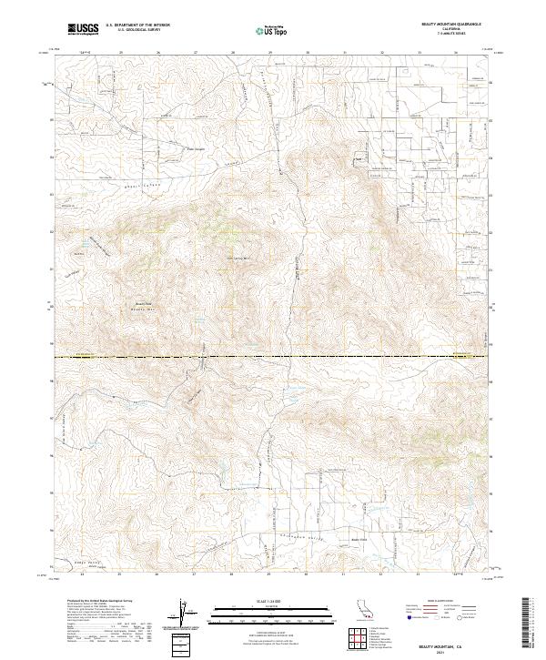
2021 Map of Beauty Mountain
USGS Topo · Published 2021About this map
Chihuahua Valley and the surrounding high-desert terrain of the Riverside and San Diego County line are captured in this modern survey. The landscape is defined by its seasonal water sources and distinct canyons, ranging from the upper reaches of the San Luis Rey River to the small pockets of greenery at Adobe Springs and Cooper Cienega. The map reveals a transition from the structured street grid of residential developments in the northeast, near Norman Rd and Ramsey Rd, to the more secluded landmarks like Boden Field and the eponymous Beauty Peak. The network of springs, including Talmadge Spring and the curiously named Million Dollar Spring, indicates the critical importance of water in this semi-arid environment, supporting both ranching history and the natural ecology of Durasno Valley and Dodge Valley.
Find a feature on this map
99 named features on this map. Tap any name to fly to it.
Don’t see what you’re looking for? This feature index may not catch every label — zoom into the map to look around manually.
Map Details
Editions of this 2021 Beauty Mountain Map
This is the sole edition of this map. No revisions or reprints were ever made.
Other maps of this area

1901 · Southern California Sheet No. 1
USGS Topo · 1:250,000

1901 · San Jacinto
USGS Topo · 1:125,000

1903 · Ramona
USGS Topo · 1:125,000

1904 · Southern California Sheet No. 2
USGS Topo · 1:250,000

1904 · Southern California Sheet No. 1
USGS Topo · 1:250,000

1939 · Warner Springs
USGS Topo · 1:62,500

1939 · Palomar Mountain
USGS Topo · 1:62,500

1940 · Hemet Reservoir
USGS Topo · 1:62,500

1942 · Hemet Reservoir
USGS Topo · 1:62,500

1942 · Hemet
USGS Topo · 1:62,500