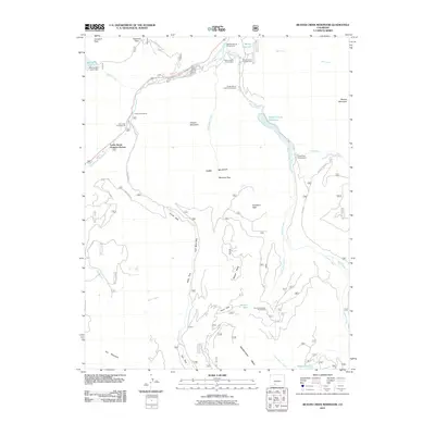
2011 Map of Beaver Creek Reservoir
USGS Topo · Published 2011About this map
Lucky Seven Summer Homes sits along the South Fork Rio Grande, serving as a focal point for seasonal residence in this high-altitude landscape. The map reveals a balance between industrial extraction and recreational use, notably at the Saint Christopher Perlite Mine located near the southern reaches of the quadrangle. Water management is a defining characteristic of the area, evidenced by the Metroz Park Lower Dam at Metroz Lake and the larger Beaver Creek Reservoir further east.
Find a feature on this map
47 named features on this map. Tap any name to fly to it.
Don’t see what you’re looking for? This feature index may not catch every label — zoom into the map to look around manually.
Map Details
Editions of this 2011 Beaver Creek Reservoir Map
This is the sole edition of this map. No revisions or reprints were ever made.
Other maps of this area

1913 · Summitville
USGS Topo · 1:125,000

1914 · Creede
USGS Topo · 1:125,000

1915 · Summitville
USGS Topo · 1:125,000

1916 · Creede
USGS Topo · 1:125,000

1945 · Durango
USGS Topo · 1:250,000

1953 · Durango
USGS Topo · 1:250,000

1954 · Durango
USGS Topo · 1:250,000

1957 · Wolf Creek Pass
USGS Topo · 1:62,500

1957 · Spar City
USGS Topo · 1:62,500

1961 · Durango
USGS Topo · 1:250,000