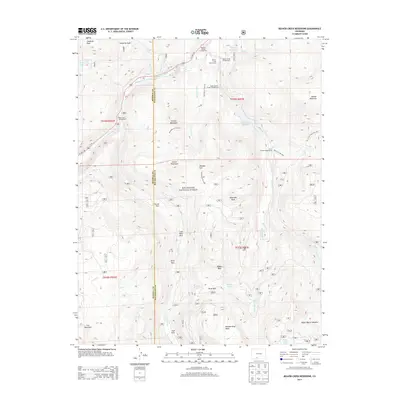
2013 Map of Beaver Creek Reservoir
USGS Topo · Published 2013About this map
Rio Grande National Forest encompasses this high-altitude landscape where the South Fork Rio Grande meets a network of vital water management features. The area is characterized by high peaks and broad mesas, including the curiously named Handkerchief Mesa and Ribbon Mesa. Human activity is centered around the Beaver Creek Reservoir and the nearby Beaver Creek Youth Camp, while higher elevations are marked by numerous named parks—natural mountain clearings—such as Coal Mine Park, Kelly Park, and Trail Park. Transportation through this backcountry relies on routes like US Hwy 160 and the Tewksberry Trail 842, which provides access to Meadow Pass. The presence of Million Reservoir and various lakes like Poage Lake and Rudifor Lake highlights the importance of water storage and drainage in this section of the San Juan Mountains.
Find a feature on this map
45 named features on this map. Tap any name to fly to it.
Don’t see what you’re looking for? This feature index may not catch every label — zoom into the map to look around manually.
Map Details
Editions of this 2013 Beaver Creek Reservoir Map
This is the sole edition of this map. No revisions or reprints were ever made.
Other maps of this area

1913 · Summitville
USGS Topo · 1:125,000

1914 · Creede
USGS Topo · 1:125,000

1915 · Summitville
USGS Topo · 1:125,000

1916 · Creede
USGS Topo · 1:125,000

1945 · Durango
USGS Topo · 1:250,000

1953 · Durango
USGS Topo · 1:250,000

1954 · Durango
USGS Topo · 1:250,000

1957 · Wolf Creek Pass
USGS Topo · 1:62,500

1957 · Spar City
USGS Topo · 1:62,500

1961 · Durango
USGS Topo · 1:250,000