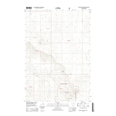
2014 Map of Beaver Flats South
USGS Topo · Published 2014About this map
Beaver Flats and the striking elevations of the Chalk Buttes dominate this landscape in Carter County. This 2014 survey captures a section of the Custer National Forest characterized by its network of drainage creeks and isolated springs, including the curiously named Bronco Sam Spring and Michael Spring. The terrain transitions from the low-lying Ewalt Cr and Flat Cr basins up toward prominent landmarks like Big Hill and Newberry Knob. This corner of Montana maintains a very rural character, with movement largely defined by unpaved routes such as Powderville Rd and Ekalaka Dump Rd. The drainage patterns of Little Beaver Cr and Spring Cr illustrate the complex hydrology of this high-plains environment, while named features like Hehn Draw point to the area's local ranching or settlement history.
Find a feature on this map
22 named features on this map. Tap any name to fly to it.
Don’t see what you’re looking for? This feature index may not catch every label — zoom into the map to look around manually.
Map Details
Editions of this 2014 Beaver Flats South Map
This is the sole edition of this map. No revisions or reprints were ever made.
Other maps of this area

1954 · Ekalaka
USGS Topo · 1:250,000

1956 · Ekalaka
USGS Topo · 1:250,000

1958 · Ekalaka
USGS Topo · 1:250,000

1965 · Ekalaka
USGS Topo · 1:250,000

1979 · Blacktail Creek SE
USGS Topo · 1:24,000

1979 · Board Corral Creek
USGS Topo · 1:24,000

1979 · Beaver Flats South
USGS Topo · 1:24,000

1979 · Dead Boy Divide
USGS Topo · 1:24,000

1979 · Chalk Buttes
USGS Topo · 1:24,000

1979 · Ekalaka
USGS Topo · 1:24,000