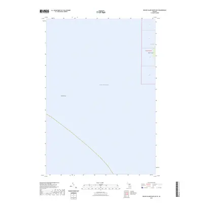
2023 Map of Beaver Island South OE W
USGS Topo · Published 2023About this map
Lake Michigan dominates this nautical landscape, capturing a quiet expanse of the archipelago's waters west of the mainland. The map centers on the open water and the submerged hazards of the lakebed, most notably Richards Reef. This limestone formation, hidden beneath the surface, is a critical reference point for maritime navigation in the passage. Along the eastern edge of the sheet, the western shoreline of Beaver Island emerges. This coastal fringe includes the sheltered waters of French Bay, providing a look at the island's natural geometry and the rugged boundary between the land and the vast freshwater sea. The presence of the Public Land Survey System grid, including sections of t37n r11w, offers a framework for researchers and genealogists tracing historic property lines and offshore boundaries in this remote corner of Charlevoix County.
Find a feature on this map
9 named features on this map. Tap any name to fly to it.
Don’t see what you’re looking for? This feature index may not catch every label — zoom into the map to look around manually.
Map Details
Editions of this 2023 Beaver Island South OE W Map
This is the sole edition of this map. No revisions or reprints were ever made.
Other maps of this area

1955 · Gull Island
USGS Topo · 1:62,500

1955 · Cheboygan
USGS Topo · 1:250,000

1956 · South Fox Island
USGS Topo · 1:62,500

1956 · Beaver Island
USGS Topo · 1:62,500

1958 · Cheboygan
USGS Topo · 1:250,000

1984 · Beaver Island
USGS Topo · 1:100,000

1984 · Charlevoix
USGS Topo · 1:100,000

1986 · High Island
USGS Topo · 1:24,000
1986 · Gull Island
USGS Topo · 1:24,000
1986 · South Fox Island
USGS Topo · 1:24,000