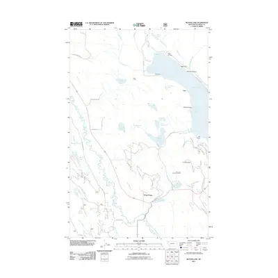
2011 Map of Beaver Lake
USGS Topo · Published 2011About this map
Whitefish Lake dominates the northeastern corner of this landscape, its shoreline defined by prominent landmarks like Inez Point, Mackinaw Point, and Eagle Point. This region of Flathead County is characterized by an intricate network of water bodies, including Beaver Lake, Little Beaver Lake, and Dollar Lake, all connected through the Beaver Creek drainage. The rugged topography near Lion Mountain provides a dramatic backdrop to the Skyles Lake area, where the Skyles Lake Sportsmans Access serves as a key recreational point.
Find a feature on this map
65 named features on this map. Tap any name to fly to it.
Don’t see what you’re looking for? This feature index may not catch every label — zoom into the map to look around manually.
Map Details
Editions of this 2011 Beaver Lake Map
This is the sole edition of this map. No revisions or reprints were ever made.
Other maps of this area

1906 · Kintla Lakes
USGS Topo · 1:125,000

1913 · Stryker
USGS Topo · 1:125,000

1916 · Stryker
USGS Topo · 1:125,000

1938 · Kintla Lakes
USGS Topo · 1:125,000

1943 · Kalispell
USGS Topo · 1:125,000

1957 · Kalispell
USGS Topo · 1:250,000

1960 · Kalispell
USGS Topo · 1:250,000

1961 · Kalispell
USGS Topo · 1:250,000

1962 · Rose Crossing
USGS Topo · 1:24,000

1962 · Beaver Lake
USGS Topo · 1:24,000