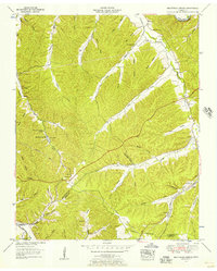
1952 Map of Beaverdam Springs
USGS Topo · Published 1957About this map
The Duck River winds through the northern portion of this landscape, marking the shift into a topography defined by complex creek drainage and narrow hollows. In the early 1950s, the rural character of the Hickman Co and Lewis Co border area is reflected in the numerous family cemeteries and small community landmarks scattered across the hills. Settlements like Beaverdam Springs and Hornertown serve as local hubs, while Nacome Camp is situated along the Sulphur Fork.
Find a feature on this map
59 named features on this map. Tap any name to fly to it.
Don’t see what you’re looking for? This feature index may not catch every label — zoom into the map to look around manually.
Map Details
Editions of this 1952 Beaverdam Springs Map
2 editions found
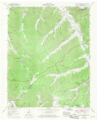
Other maps of this area

1901 · Colombia
USGS Topo · 1:125,000

1936 · Graves Spring
USGS Topo · 1:24,000

1936 · Pleasantville
USGS Topo · 1:24,000

1936 · Coble
USGS Topo · 1:24,000

1936 · Beaverdam Springs
USGS Topo · 1:24,000

1936 · Nunnelly
USGS Topo · 1:24,000

1936 · Whitfield
USGS Topo · 1:24,000

1936 · Sunrise
USGS Topo · 1:24,000

1936 · Kimmins
USGS Topo · 1:24,000

1936 · Gordonsburg
USGS Topo · 1:24,000