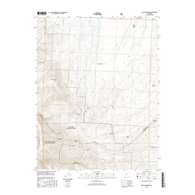
2016 Map of Beck Mountain
USGS Topo · Published 2016About this map
San Isabel National Forest and the Great Sand Dunes National Preserve meet along the high ridges of the Sangre de Cristo Range in this 2016 study. The landscape is defined by its dramatic elevation changes, from the edges of the Wet Mountain Valley to peaks like Snowslide Mtn and Blizzardine Peak. The Rainbow Trail serves as a primary longitudinal artery, tracing the eastern slopes and connecting high-altitude features such as Loco Park and Mid Knob. Water management and natural drainage are evident through the Hudson Ditch and numerous creeks like Grape Cr and Cottonwood Cr that flow toward the valley floor. This map documents a transition point between preserved wilderness and the ranching lands of the Wet Mountain Valley, marked by the Promontory Divide at the boundary of Custer and Huerfano counties.
Find a feature on this map
50 named features on this map. Tap any name to fly to it.
Don’t see what you’re looking for? This feature index may not catch every label — zoom into the map to look around manually.
Map Details
Editions of this 2016 Beck Mountain Map
This is the sole edition of this map. No revisions or reprints were ever made.
Other maps of this area

1889 · Canon City
USGS Topo · 1:125,000

1889 · Huerfano Park
USGS Topo · 1:125,000

1892 · Huerfano Park
USGS Topo · 1:125,000

1892 · Canon City
USGS Topo · 1:125,000

1954 · Rosita
USGS Topo · 1:24,000

1954 · Trinidad
USGS Topo · 1:250,000

1954 · Pueblo
USGS Topo · 1:250,000

1955 · Trinidad
USGS Topo · 1:250,000

1957 · Pueblo
USGS Topo · 1:250,000

1957 · Aldrich Gulch
USGS Topo · 1:24,000