
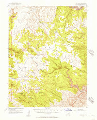
1953 Map of Beckwith Peak SW
USGS Topo · Published 1954About this map
San Rafael Mesa dominates this central Utah landscape, defined by the deep incisions of the San Rafael River and its various tributaries. Surveyed in the early 1950s, the map reveals a remote terrain where human intervention is sparse but significant. Traces of past industry and transit are evident in the notation of a Railroad Dismantled and a small Dam along the watercourses. The presence of Smith Cabin near Tidwell Draw provides a specific point of interest for local historians, marking a rare named habitation in this drainage basin. The intricate contour lines illustrate the complex erosion patterns from Nates Canyon to Cottonwood Wash, showing the region as it existed before further development. This preliminary edition captures the rugged geography of Emery County at a time when older transport routes were being reclaimed by the desert floor.
Find a feature on this map
9 named features on this map. Tap any name to fly to it.
Don’t see what you’re looking for? This feature index may not catch every label — zoom into the map to look around manually.
Map Details
Editions of this 1953 Beckwith Peak SW Map
This is the sole edition of this map. No revisions or reprints were ever made.
Other maps of this area

1885 · San Rafael
USGS Topo · 1:250,000

1886 · Price River
USGS Topo · 1:250,000

1896 · Price River
USGS Topo · 1:250,000

1953 · Red Plateau SE
USGS Topo · 1:24,000

1953 · Tidwell 2 NW
USGS Topo · 1:24,000

1954 · Stinking Spring Creek 1 NE
USGS Topo · 1:24,000

1954 · Tidwell 2 NE
USGS Topo · 1:24,000

1954 · Tidwell Bottoms
USGS Topo · 1:62,500
1954 · The Wickiup
USGS Topo · 1:62,500

1956 · Salina
USGS Topo · 1:250,000