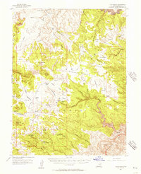
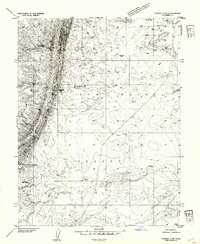
1954 Map of The Wickiup
USGS Topo · Published 1957About this map
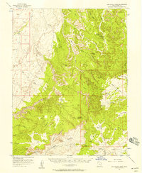
Sinbad country and the San Rafael Swell characterize this mid-century desert landscape, where the San Rafael River cuts through the deep gorge of the Black Box. The map reveals a remote territory marked by resource exploration and ranching history, evidenced by the Oil Well Test Holes (Aban'd) and various water features named for local figures, such as Charley Holes and Crawford Holes. High-elevation landmarks like The Wickiup and Block Mtn rise above extensive sagebrush flats and benches. A network of primitive transport is visible via the Jeep Trail, providing access to isolated spots like Arsons Garden and Lone Parson Hole before the era of modern highway development. The eastern edge is defined by the sharp tilt of the San Rafael Reef, which creates a natural barrier across the terrain.
Find a feature on this map
47 named features on this map. Tap any name to fly to it.
Don’t see what you’re looking for? This feature index may not catch every label — zoom into the map to look around manually.
Map Details
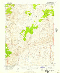
Editions of this 1954 The Wickiup Map
3 editions found
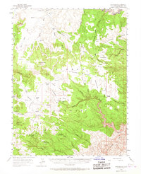
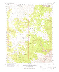
Other maps of this area

1885 · San Rafael
USGS Topo · 1:250,000

1886 · Price River
USGS Topo · 1:250,000

1896 · Price River
USGS Topo · 1:250,000
1952 · Wild Horse
USGS Topo · 1:62,500
1952 · San Rafael Knob
USGS Topo · 1:62,500
1953 · Stinking Spring Creek 2 SE
USGS Topo · 1:24,000
1953 · Wilsonville SE
USGS Topo · 1:24,000
1953 · Red Plateau SE
USGS Topo · 1:24,000
1953 · Tidwell 2 SW
USGS Topo · 1:24,000
1953 · Red Plateau SW
USGS Topo · 1:24,000