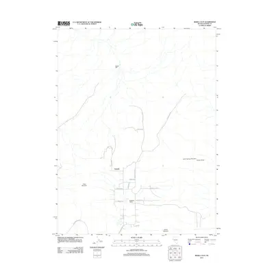
2011 Map of Bedell Flat
USGS Topo · Published 2011About this map
Nashville and the adjacent Antelope Valley settlement represent the primary human presence in this high-desert basin. The landscape is defined by the broad, dry expanse of Bedell Flat in the north, framed by several significant topographic features. These include Warm Springs Mountain and the Hungry Range to the east, while Freds Mountain and Hungry Mountain anchor the western and southern reaches. The map reveals a network of roads often named for local geographic landmarks, such as Prospect Hill Rd, Marble Point Rd, and Alum Rock Rd, which branch out to serve the scattered residential lots and ranching properties. This pattern of development illustrates a shift from open rangeland to rural residential blocks, particularly along Serpentine Rd and Mineral Flat Rd, where the grid-like partitioning of the valley floor becomes most evident.
Find a feature on this map
21 named features on this map. Tap any name to fly to it.
Don’t see what you’re looking for? This feature index may not catch every label — zoom into the map to look around manually.
Map Details
Editions of this 2011 Bedell Flat Map
This is the sole edition of this map. No revisions or reprints were ever made.
Other maps of this area

1891 · Reno
USGS Topo · 1:125,000

1893 · Reno
USGS Topo · 1:125,000

1950 · Reno
USGS Topo · 1:62,500

1951 · Reno
USGS Topo · 1:62,500

1957 · Sutcliffe
USGS Topo · 1:62,500

1957 · Dogskin Mountain
USGS Topo · 1:62,500

1957 · Spanish Springs Valley
USGS Topo · 1:62,500

1957 · Reno
USGS Topo · 1:250,000

1959 · Reno
USGS Topo · 1:250,000

1960 · Reno
USGS Topo · 1:250,000