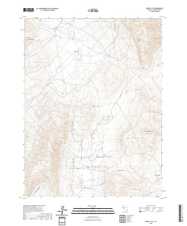
2023 Map of Bedell Flat
USGS Topo · Published 2023About this map
Bedell Flat and its surrounding basins define this high-altitude section of Washoe County, where the topography transitions between prominent peaks and expansive valleys. The terrain is dominated by several distinct heights, including the French Mountains to the northwest and the Dogskin Mountain to the northeast. A network of primitive roads and residential lanes, such as Alum Rock Rd and Matterhorn Blvd, provides access through the southern reaches near Antelope Valley. The mapping of townships like t22n r19e reveals a landscape primarily shaped by natural drainage patterns rather than dense urban development. Moving south, the terrain climbs toward Freds Mtn and Hungry Mtn, with Hungry Valley tucked between the ridges. This contemporary survey preserves the naming of specific geographic landmarks, from the Sand Hills to the rugged Hungry Range, providing a clear look at how human infrastructure interacts with the Great Basin's natural elevations.
Find a feature on this map
27 named features on this map. Tap any name to fly to it.
Don’t see what you’re looking for? This feature index may not catch every label — zoom into the map to look around manually.
Map Details
Editions of this 2023 Bedell Flat Map
This is the sole edition of this map. No revisions or reprints were ever made.
Other maps of this area

1891 · Reno
USGS Topo · 1:125,000

1893 · Reno
USGS Topo · 1:125,000

1950 · Reno
USGS Topo · 1:62,500

1951 · Reno
USGS Topo · 1:62,500

1957 · Sutcliffe
USGS Topo · 1:62,500

1957 · Dogskin Mountain
USGS Topo · 1:62,500

1957 · Spanish Springs Valley
USGS Topo · 1:62,500

1957 · Reno
USGS Topo · 1:250,000

1959 · Reno
USGS Topo · 1:250,000

1960 · Reno
USGS Topo · 1:250,000