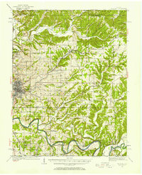
1986 Map of Bedford
USGS Topo · Published 1986About this map
Bedford serves as the industrial and logistical hub for this Southern Indiana region in the mid-1980s, where the White River and its East Fork White River snake through a landscape defined by limestone production and heavy rail. The map documents the significant footprint of the Crane Naval Weapons Support Center in the northwest, while the southeastern corner is dominated by the sprawling reaches of the Hoosier National Forest. Transportation networks are notably dense, featuring the crossing lines of the Baltimore and Ohio Railroad, the Milwaukee Road, and the Southern Railway. Beyond the quarries and industrial sites, the map details established leisure and heritage locations such as French Lick, the historic Becks Mill, and Spring Mill State Park. This survey provides a clear view of the balance between federal land management, historic southern Indiana settlements like Paoli and Salem, and the active extractive industries of the period.
Find a feature on this map
126 named features on this map. Tap any name to fly to it.
Don’t see what you’re looking for? This feature index may not catch every label — zoom into the map to look around manually.
Map Details
Editions of this 1986 Bedford Map
This is the sole edition of this map. No revisions or reprints were ever made.
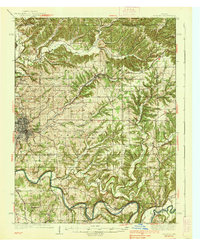
Historical Maps of Bedford Through Time
4 maps found