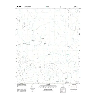
2011 Map of Bee Branch
USGS Topo · Published 2011About this map
Rabbittown stands as the primary settlement in this corner of the William B. Bankhead National Forest, situated near the prominent Balls Mountain. The landscape is defined by the intricate drainage systems of the Sipsey Fork and its numerous tributaries, which have carved distinctive geological features such as Big Tree Canyon, Little Ugly Canyon, and Needles Eye. This 2011 survey reveals a territory where deep ravines and high ridges dictate the path of travel, with modern forest service roads like Cranal Rd following the high ground between watersheds.
Find a feature on this map
54 named features on this map. Tap any name to fly to it.
Don’t see what you’re looking for? This feature index may not catch every label — zoom into the map to look around manually.
Map Details
Editions of this 2011 Bee Branch Map
This is the sole edition of this map. No revisions or reprints were ever made.
Other maps of this area

1935 · Moulton
USGS Topo · 1:24,000

1936 · Newburg
USGS Topo · 1:24,000

1936 · Delmar
USGS Topo · 1:24,000

1936 · Kinlock Spring
USGS Topo · 1:24,000

1936 · Moulton
USGS Topo · 1:48,000

1936 · Landersville
USGS Topo · 1:24,000

1940 · Mt Hope
USGS Topo · 1:62,500
1945 · Newburg
USGS Topo · 1:24,000
1947 · Newburg
USGS Topo · 1:24,000

1947 · Kinlock Spring
USGS Topo · 1:24,000