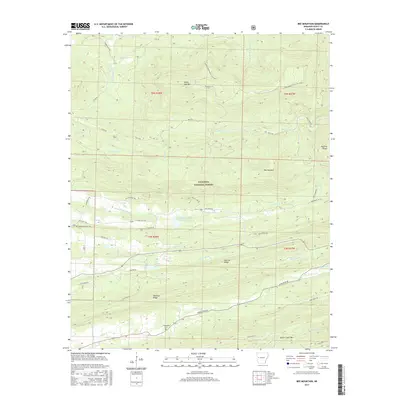
2017 Map of Bee Mountain
USGS Topo · Published 2017About this map
Ouachita National Forest dominates this Scott County landscape, where the high elevations of Bee Mountain and White Oak Mtn overlook a complex network of river forks and ridges. The drainage patterns are particularly distinct, with the Petit Jean River flowing through the northern sections while the E Fork Poteau River and Poteau River converge further south near Selkirk Lake. This 2017 survey illustrates the modern intersection of conservation land and rural history, preserving the locations of the Mount Pleasant Cem and Friendship Cem. The terrain is defined by dramatic geological features like Narrow Ridge and Waldron Ridge, which run parallel to the winding course of Dutch Cr. A developed network of forest roads and paths, including the Sugar Creek Multi-Use Trail and Buck Trl, provides access through the heavily wooded interior of the national forest.
Find a feature on this map
49 named features on this map. Tap any name to fly to it.
Don’t see what you’re looking for? This feature index may not catch every label — zoom into the map to look around manually.
Map Details
Editions of this 2017 Bee Mountain Map
This is the sole edition of this map. No revisions or reprints were ever made.
Other maps of this area

1879 · Poteau Mountain
USGS Topo · 1:62,500

1887 · Poteau Mountain #1
USGS Topo · 1:62,500

1887 · Mount Ida #2
USGS Topo · 1:62,500

1887 · Magazine Mountain #3
USGS Topo · 1:62,500

1887 · Magazine Mountain
USGS Topo · 1:62,500

1890 · Magazine Mountain
USGS Topo · 1:125,000

1890 · Mount Ida
USGS Topo · 1:125,000

1890 · Fort Smith
USGS Topo · 1:125,000

1890 · Poteau Mountain
USGS Topo · 1:125,000

1899 · Poteau Mountain
USGS Topo · 1:125,000