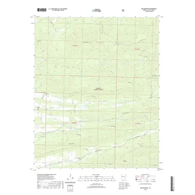
2020 Map of Bee Mountain
USGS Topo · Published 2020About this map
The Ouachita National Forest dominates this section of Scott County, where the topography is defined by a series of parallel sandstone ridges and narrow valleys. The Poteau River and its tributary, the E Fork Poteau River, carve through the central landscape, while the Petit Jean River flows across the northern reaches near Round Mtn. This area is characterized by long, linear features like Waldron Ridge and Dutch Creek Mtn, which restrict travel to specific corridors such as State Hwy 248. Small-scale water management is evident at Moore Lake and Selkirk Lake, positioned near the valley floors. For those researching local heritage, the presence of Mount Pleasant Cem and Friendship Cem provides specific points of interest amidst the timberlands and ridge-top terrain.
Find a feature on this map
51 named features on this map. Tap any name to fly to it.
Don’t see what you’re looking for? This feature index may not catch every label — zoom into the map to look around manually.
Map Details
Editions of this 2020 Bee Mountain Map
This is the sole edition of this map. No revisions or reprints were ever made.
Other maps of this area

1879 · Poteau Mountain
USGS Topo · 1:62,500

1887 · Poteau Mountain #1
USGS Topo · 1:62,500

1887 · Mount Ida #2
USGS Topo · 1:62,500

1887 · Magazine Mountain #3
USGS Topo · 1:62,500

1887 · Magazine Mountain
USGS Topo · 1:62,500

1890 · Magazine Mountain
USGS Topo · 1:125,000

1890 · Mount Ida
USGS Topo · 1:125,000

1890 · Fort Smith
USGS Topo · 1:125,000

1890 · Poteau Mountain
USGS Topo · 1:125,000

1899 · Poteau Mountain
USGS Topo · 1:125,000