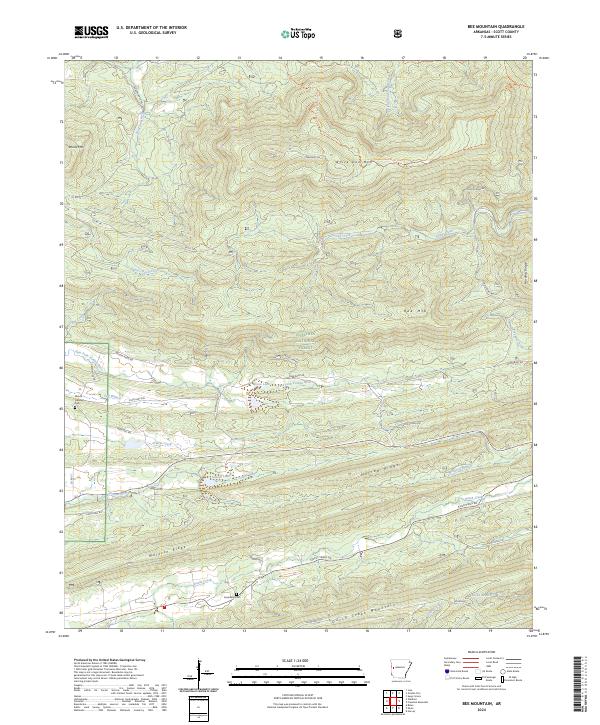
2024 Map of Bee Mountain
USGS Topo · Published 2024About this map
Ouachita National Forest blankets this section of Scott County, where the hydrology of western Arkansas is defined by the parallel ridges and valleys of the interior highlands. The terrain is structured by prominent landforms such as Waldron Ridge and Dutch Creek Mountain, which funnel numerous waterways through the landscape. The Poteau River and its East Fork Poteau River dominate the central valley, while the Petit Jean River and Sugar Creek drain the northern reaches. Settlement patterns follow the lowlands and foothills, with sites like Mount Pleasant Cem and Friendship Cem providing touchpoints for local genealogical research. Small bodies of water including Moore Lake and Selkirk Lake sit near the transition from forest to agricultural land, connected by a network of rural routes like State Hwy 248 and various timber and access roads.
Find a feature on this map
50 named features on this map. Tap any name to fly to it.
Don’t see what you’re looking for? This feature index may not catch every label — zoom into the map to look around manually.
Map Details
Editions of this 2024 Bee Mountain Map
This is the sole edition of this map. No revisions or reprints were ever made.
Other maps of this area

1879 · Poteau Mountain
USGS Topo · 1:62,500

1887 · Poteau Mountain #1
USGS Topo · 1:62,500

1887 · Mount Ida #2
USGS Topo · 1:62,500

1887 · Magazine Mountain #3
USGS Topo · 1:62,500

1887 · Magazine Mountain
USGS Topo · 1:62,500

1890 · Magazine Mountain
USGS Topo · 1:125,000

1890 · Mount Ida
USGS Topo · 1:125,000

1890 · Fort Smith
USGS Topo · 1:125,000

1890 · Poteau Mountain
USGS Topo · 1:125,000

1899 · Poteau Mountain
USGS Topo · 1:125,000