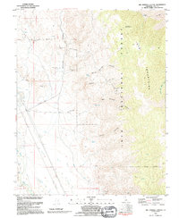
1992 Map of Bee Springs Canyon
USGS Topo · Published 1995About this map
Inyo Mountains dominate this 1990s survey of the high desert east of the Owens River. The landscape is defined by the steep drainage of Mazourka Canyon and Bee Springs Canyon, where the arid terrain is punctuated by critical water sources like Willow Springs and Bee Springs. High on the eastern ridge, the Winnedumah Paiute Monument overlooks the valley below, serving as a prominent geographical and cultural landmark.
Find a feature on this map
31 named features on this map. Tap any name to fly to it.
Don’t see what you’re looking for? This feature index may not catch every label — zoom into the map to look around manually.
Map Details
Editions of this 1992 Bee Springs Canyon Map
This is the sole edition of this map. No revisions or reprints were ever made.
Other maps of this area

1907 · Mt. Whitney
USGS Topo · 1:125,000

1908 · Ballarat
USGS Topo · 1:250,000

1913 · Ballarat
USGS Topo · 1:250,000

1919 · Mt. Whitney
USGS Topo · 1:125,000

1937 · Mt. Whitney
USGS Topo · 1:125,000

1948 · Death Valley
USGS Topo · 1:250,000

1948 · Fresno
USGS Topo · 1:250,000

1950 · New York Butte
USGS Topo · 1:62,500

1951 · New York Butte
USGS Topo · 1:62,500

1951 · Waucoba Wash
USGS Topo · 1:62,500