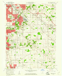
1959 Map of Beech Grove
USGS Topo · Published 1961About this map
Beech Grove serves as the industrial and transit hub of this 1959 survey, dominated by the massive rail yard facilities of the New York Central RR. The surrounding landscape in southeastern Indianapolis shows a period of rapid suburban transition, where new residential developments like Twin Brooks and Rosedale Hills begin to push into the agricultural fields of Franklin and Perry townships. The local institutional fabric is well-represented by parochial centers such as Holy Name Sch & Ch and the St Francis Hospital complex.
Find a feature on this map
105 named features on this map. Tap any name to fly to it.
Don’t see what you’re looking for? This feature index may not catch every label — zoom into the map to look around manually.
Map Details
Editions of this 1959 Beech Grove Map
This is the sole edition of this map. No revisions or reprints were ever made.
Other maps of this area

1948 · Indianapolis East
USGS Topo · 1:24,000

1948 · Maywood
USGS Topo · 1:24,000

1948 · Beech Grove
USGS Topo · 1:24,000

1948 · Indianapolis West
USGS Topo · 1:24,000

1952 · Cumberland
USGS Topo · 1:24,000

1952 · Bargersville
USGS Topo · 1:24,000

1953 · Greenwood
USGS Topo · 1:24,000

1953 · Acton
USGS Topo · 1:24,000

1953 · Boggstown
USGS Topo · 1:24,000

1953 · Cincinnati
USGS Topo · 1:250,000
Featured Places
- Indianapolis, IN
- Greenwood, IN
- Beech Grove, Indianapolis
- Homecroft, Indianapolis
- Ingallston, Beech Grove