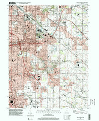
1998 Map of Beech Grove
USGS Topo · Published 2002About this map
Beech Grove and the expanding suburbs of southeastern Indianapolis are defined by a complex network of transportation and community institutions at the end of the century. The heavy industrial footprint of the Conrail lines contrasts with the residential growth spreading through Franklin and Perry townships. Local history is anchored by long-standing religious and educational centers, including Holy Name Sch & Ch and the expansive grounds of St Francis Hospital. The landscape transitions from the dense urban grid of Indianapolis in the northwest toward more dispersed settlements like Wanamaker and Five Points. Natural drainage features like Lick Creek and Buck Creek provide a winding counterpoint to the rigid Interstate interchanges and modern infrastructure developments that characterize this era of Indiana's urban expansion.
Find a feature on this map
67 named features on this map. Tap any name to fly to it.
Don’t see what you’re looking for? This feature index may not catch every label — zoom into the map to look around manually.
Map Details
Editions of this 1998 Beech Grove Map
This is the sole edition of this map. No revisions or reprints were ever made.
Other maps of this area

1948 · Indianapolis East
USGS Topo · 1:24,000

1948 · Maywood
USGS Topo · 1:24,000

1948 · Beech Grove
USGS Topo · 1:24,000

1948 · Indianapolis West
USGS Topo · 1:24,000

1952 · Cumberland
USGS Topo · 1:24,000

1952 · Bargersville
USGS Topo · 1:24,000

1953 · Greenwood
USGS Topo · 1:24,000

1953 · Acton
USGS Topo · 1:24,000

1953 · Boggstown
USGS Topo · 1:24,000

1953 · Cincinnati
USGS Topo · 1:250,000
Featured Places
- Indianapolis, IN
- Greenwood, IN
- Beech Grove, Indianapolis
- Homecroft, Indianapolis
- Ingallston, Beech Grove