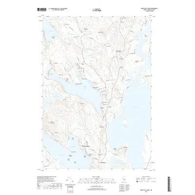
2018 Map of Beech Hill Pond
USGS Topo · Published 2018About this map
The rugged interior of Hancock County is defined by the expansive waters of Beech Hill Pond and the northern reaches of Graham Lake. In the small settlement of Otis, the landscape is marked by Jordan Ledge and Schoolhouse Cove, while to the northeast, Mariaville sits near the winding course of Tannery Brook. This part of Maine maintains a pattern of dispersed homesteads and rural roads such as Dority Farm Rd and Morrison Farm Rd, reflecting the area's agricultural and timber-linked heritage.
Find a feature on this map
115 named features on this map. Tap any name to fly to it.
Don’t see what you’re looking for? This feature index may not catch every label — zoom into the map to look around manually.
Map Details
Editions of this 2018 Beech Hill Pond Map
This is the sole edition of this map. No revisions or reprints were ever made.
Other maps of this area

1900 · Orland
USGS Topo · 1:62,500

1902 · Orono
USGS Topo · 1:62,500

1911 · Ellsworth
USGS Topo · 1:62,500

1929 · Great Pond
USGS Topo · 1:48,000

1932 · Great Pond
USGS Topo · 1:62,500

1940 · Ellsworth
USGS Topo · 1:62,500

1942 · Orland
USGS Topo · 1:62,500

1942 · Ellsworth
USGS Topo · 1:62,500

1944 · Orono
USGS Topo · 1:62,500

1946 · Orono
USGS Topo · 1:62,500