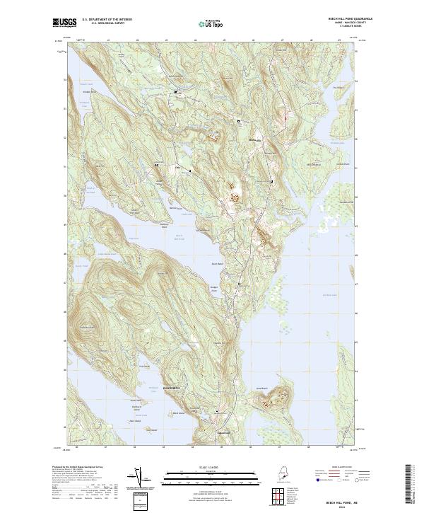
2024 Map of Beech Hill Pond
USGS Topo · Published 2024About this map
The Green Lake National Fish Hatchery anchors the southern portion of this landscape, reflecting a long-standing commitment to local aquatic conservation and habitat management. Surrounding this facility is a network of water bodies, including Green Lake and the expansive Beech Hill Pond, which are separated by high ridges like Grotto Hill and Hopkins Hill. The settlement patterns in Otis and Mariaville are defined by family-named cemeteries and historical transit corridors, such as the Otis Rd and Mariaville Rd.
Find a feature on this map
123 named features on this map. Tap any name to fly to it.
Don’t see what you’re looking for? This feature index may not catch every label — zoom into the map to look around manually.
Map Details
Editions of this 2024 Beech Hill Pond Map
This is the sole edition of this map. No revisions or reprints were ever made.
Other maps of this area

1900 · Orland
USGS Topo · 1:62,500

1902 · Orono
USGS Topo · 1:62,500

1911 · Ellsworth
USGS Topo · 1:62,500

1929 · Great Pond
USGS Topo · 1:48,000

1932 · Great Pond
USGS Topo · 1:62,500

1940 · Ellsworth
USGS Topo · 1:62,500

1942 · Orland
USGS Topo · 1:62,500

1942 · Ellsworth
USGS Topo · 1:62,500

1944 · Orono
USGS Topo · 1:62,500

1946 · Orono
USGS Topo · 1:62,500