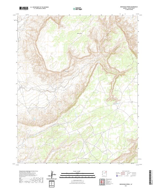
2021 Map of Beeshsikad Spring
USGS Topo · Published 2021About this map
Balakai Mesa dominates this high-desert landscape in Apache County, where the topography is defined by intricate drainage patterns and isolated water sources. This portion of the Navajo Nation is characterized by a series of critical springs that have long sustained life in an arid environment, including Beeshsikad Spring, Oak Spring, and Antelope Trail Spring. The presence of these named water features suggests their importance for traditional land use and livestock. To the south, Jeddito Wash snakes through the lower elevations, while Owl Hat Point provides a prominent landmark along the mesa's edge. This modern survey by the U.S. Geological Survey shows a landscape with very limited road infrastructure, primarily centered around Indian Rte 8059, reflecting the preservation of vast, open terrain.
Find a feature on this map
12 named features on this map. Tap any name to fly to it.
Don’t see what you’re looking for? This feature index may not catch every label — zoom into the map to look around manually.
Map Details
Editions of this 2021 Beeshsikad Spring Map
This is the sole edition of this map. No revisions or reprints were ever made.
Other maps of this area

1883 · Marsh Pass
USGS Topo · 1:250,000

1883 · Tusayan
USGS Topo · 1:250,000

1886 · Tusayan
USGS Topo · 1:250,000

1886 · Fort Defiance
USGS Topo · 1:250,000

1892 · Fort Defiance
USGS Topo · 1:250,000

1892 · Marsh Pass
USGS Topo · 1:250,000

1892 · Canyon De Chelly
USGS Topo · 1:250,000

1947 · Flagstaff
USGS Topo · 1:250,000

1954 · Shiprock
USGS Topo · 1:250,000

1954 · Flagstaff
USGS Topo · 1:250,000