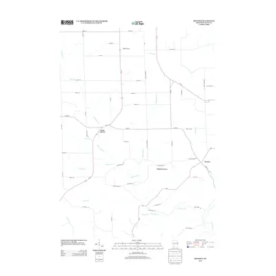
2013 Map of Beetown
USGS Topo · Published 2013About this map
Beetown and the surrounding Grant County landscape appear in this modern survey, defined by the intricate drainage systems of the Grant River and its numerous tributaries. The terrain transitions from the open expanses of Blake Prairie in the north to the more dissected valleys of the south. Small settlements like North Andover and Diamond Grove anchor the local road network, which is characterized by several long-established routes such as Diamond Grove Rd and Cemetery Rd. The map reveals the importance of water resources to the area's development, as evidenced by the dense cluster of named creeks including Rattlesnake Cr, Muskellunge Cr, and Kuenster Cr. Named local roads like Budworth School Rd and Tin Can Ln provide specific landmarks for genealogists and local historians tracing property lines and former school districts in this corner of Wisconsin.
Find a feature on this map
53 named features on this map. Tap any name to fly to it.
Don’t see what you’re looking for? This feature index may not catch every label — zoom into the map to look around manually.
Map Details
Editions of this 2013 Beetown Map
This is the sole edition of this map. No revisions or reprints were ever made.
Other maps of this area

1900 · Lancaster
USGS Topo · 1:125,000

1902 · Elkader
USGS Topo · 1:125,000

1904 · Lancaster
USGS Topo · 1:125,000

1908 · Lancaster
USGS Topo · 1:125,000

1955 · Cassville
USGS Topo · 1:24,000

1955 · Balltown
USGS Topo · 1:24,000

1957 · Turkey River
USGS Topo · 1:24,000

1959 · Dubuque
USGS Topo · 1:250,000

1961 · Dubuque
USGS Topo · 1:250,000

1962 · Dubuque
USGS Topo · 1:250,000