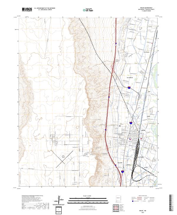
2023 Map of Belen
USGS Topo · Published 2023About this map
The town of Belen serves as a central hub for this Rio Grande Valley corridor, where an intricate network of irrigation channels like the Belen Highline Canal and Garcia Lateral Number 1 supports the local agriculture. This survey documents the complex water management system of drains, ditches, and laterals that define the valley floor, contrasted against the rising elevation of Mesa and Sunrise Bluff to the west. The landscape is characterized by its linear settlements following the river's path, including Los Chavez, Los Trujillos, and Pueblitos. The BNSF Railway corridor remains a dominant infrastructure feature, paralleling the major roadways and connecting the various neighborhoods. Notable local sites range from the Belen Regional Airport on the western flats to the Our Lady of Belen Memorial Gardens Cem near the town center, illustrating the blend of modern aviation and deep-rooted community heritage.
Find a feature on this map
104 named features on this map. Tap any name to fly to it.
Don’t see what you’re looking for? This feature index may not catch every label — zoom into the map to look around manually.
Map Details
Editions of this 2023 Belen Map
This is the sole edition of this map. No revisions or reprints were ever made.
Other maps of this area

1952 · Dalies
USGS Topo · 1:24,000

1952 · Belen SW
USGS Topo · 1:24,000

1952 · Belen
USGS Topo · 1:24,000

1952 · Turn
USGS Topo · 1:24,000

1952 · Veguita
USGS Topo · 1:24,000

1952 · Belen NW
USGS Topo · 1:24,000

1952 · Rio Puerco
USGS Topo · 1:24,000

1952 · Tome
USGS Topo · 1:24,000

1952 · Los Lunas
USGS Topo · 1:24,000

1954 · Socorro
USGS Topo · 1:250,000