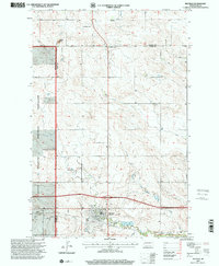
1997 Map of Belfield
USGS Topo · Published 2001About this map
Belfield serves as a focal point for this late-twentieth-century landscape where the Heart River and Coal Mine Creek intersect. The terrain is marked by the industrial history of the region, featuring several Scoria Pits and numerous Mines that dot the prairie. To the west, the boundary of the Little Missouri National Grassland introduces a distinct land-use transition, while the Fifteenth Guide Meridian West and the Billings and Stark County line provide a formal grid to the undulating topography. Genealogists will find the St Stanislaus Cem and a southern Cemetery near the town center useful for tracing local family roots. Further north, Six Mile Corner and the prominent Saddle Butte stand as enduring landmarks in this segment of the North Dakota badlands.
Find a feature on this map
24 named features on this map. Tap any name to fly to it.
Don’t see what you’re looking for? This feature index may not catch every label — zoom into the map to look around manually.
Map Details
Editions of this 1997 Belfield Map
This is the sole edition of this map. No revisions or reprints were ever made.
Other maps of this area

1953 · Dickinson
USGS Topo · 1:250,000

1953 · Watford City
USGS Topo · 1:250,000

1957 · Dickinson
USGS Topo · 1:250,000

1957 · Watford City
USGS Topo · 1:250,000

1962 · Fryburg NE
USGS Topo · 1:24,000

1962 · Belfield NE
USGS Topo · 1:24,000

1962 · Belfield SW
USGS Topo · 1:24,000

1962 · Fryburg
USGS Topo · 1:24,000

1962 · Belfield
USGS Topo · 1:24,000

1962 · Belfield SE
USGS Topo · 1:24,000