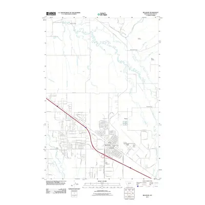
2011 Map of Belgrade
USGS Topo · Published 2011About this map
The city of Belgrade serves as the focal point of this Gallatin Valley landscape, characterized by its grid of residential streets and the critical infrastructure of the Gallatin Field Airport. The area’s genealogical value is anchored by several historic burial grounds, including Courts Cemetery, Reese Creek Cemetery, and the East Gallatin Cemetery. The river system is particularly intricate here, with the East Gallatin River fed by a network of tributaries such as Smith Creek, Story Creek, and Reese Creek. These waterways are crossed by named landmarks like Nelson Bridge and Penwell Bridge, which have historically facilitated movement across the fertile valley floor. In the rural outskirts, agricultural and residential patterns are preserved along roads like Dry Creek School Rd, pointing to the region's earlier educational and community structure. To the north, the small settlement of Powers and the Lexley Acres Campground reflect the continued residential and recreational development of the county.
Find a feature on this map
112 named features on this map. Tap any name to fly to it.
Don’t see what you’re looking for? This feature index may not catch every label — zoom into the map to look around manually.
Map Details
Editions of this 2011 Belgrade Map
This is the sole edition of this map. No revisions or reprints were ever made.
Other maps of this area

1888 · Three Forks
USGS Topo · 1:250,000

1894 · Three Forks
USGS Topo · 1:250,000

1895 · Three Forks
USGS Topo · 1:250,000

1947 · Bozeman
USGS Topo · 1:250,000

1948 · Bozeman
USGS Topo · 1:250,000

1949 · Anceney
USGS Topo · 1:62,500

1949 · Manhattan
USGS Topo · 1:62,500

1950 · Belgrade
USGS Topo · 1:62,500

1953 · Bozeman
USGS Topo · 1:62,500

1955 · Bozeman
USGS Topo · 1:250,000