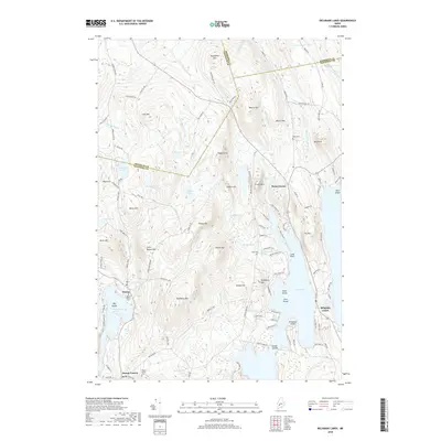
2018 Map of Belgrade Lakes
USGS Topo · Published 2018About this map
Belgrade Lakes sits at the narrowest point of land between the sprawling Great Pond and Long Pond, serving as a focal point for this lake-strewn portion of the Maine interior. The landscape is a mosaic of steep ridges and clear basins, dominated by elevations like Mcgaffey Mtn, Vienna Mtn, and Hampshire Hill. In the western reaches, the village of Vienna clusters near Mill Pond and Flying Pond, while Mount Vernon appears at the southern edge. Local history is anchored by several burial grounds, including the Vienna Town Cem, Rome Cem, and the Haynes Hovey Cem. The map reveals a transition from traditional village centers to modern seasonal developments, evidenced by numerous private estates and roads such as Echo Valley Ests and Barber Ests lining the shores of the larger water bodies.
Find a feature on this map
121 named features on this map. Tap any name to fly to it.
Don’t see what you’re looking for? This feature index may not catch every label — zoom into the map to look around manually.
Map Details
Editions of this 2018 Belgrade Lakes Map
This is the sole edition of this map. No revisions or reprints were ever made.
Other maps of this area

1892 · Augusta
USGS Topo · 1:62,500

1894 · Norridgewock
USGS Topo · 1:62,500

1898 · Norridgewock
USGS Topo · 1:62,500

1910 · Livermore
USGS Topo · 1:62,500

1912 · Livermore
USGS Topo · 1:62,500

1924 · Farmington
USGS Topo · 1:62,500

1941 · Livermore
USGS Topo · 1:62,500

1941 · Augusta
USGS Topo · 1:62,500

1943 · Augusta
USGS Topo · 1:62,500

1943 · Norridgewock
USGS Topo · 1:62,500