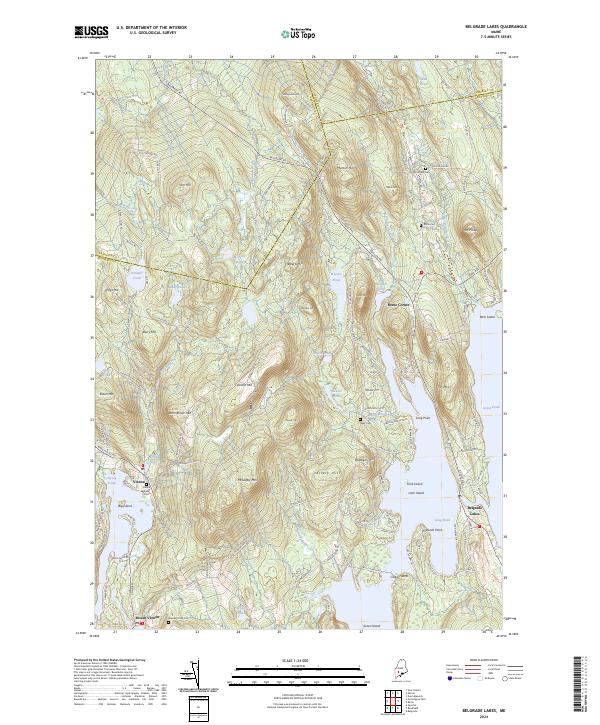
2024 Map of Belgrade Lakes
USGS Topo · Published 2024About this map
Belgrade Lakes sits at the narrow passage between the expansive waters of Long Pond and Great Pond, serving as a central hub for this lake-dominated terrain in Kennebec County. The landscape is defined by significant elevations like McGaffey Mtn and Vienna Mtn, which rise sharply above the intricate network of brooks and ponds. Local history is anchored by settlements such as Vienna, Rome Corner, and Mount Vernon, alongside several small burial grounds including Brookside Cem and Vienna Town Cem. This 2024 survey details the complex shoreline geography, featuring landforms like Long Point and Pinewold Point, while also tracing the routes of Belgrade Rd and Augusta Rd as they navigate the ridges and wetlands. The map provides a clear picture of modern land use in a region historically characterized by its seasonal lakeside communities and agricultural upland heritage.
Find a feature on this map
71 named features on this map. Tap any name to fly to it.
Don’t see what you’re looking for? This feature index may not catch every label — zoom into the map to look around manually.
Map Details
Editions of this 2024 Belgrade Lakes Map
This is the sole edition of this map. No revisions or reprints were ever made.
Other maps of this area

1892 · Augusta
USGS Topo · 1:62,500

1894 · Norridgewock
USGS Topo · 1:62,500

1898 · Norridgewock
USGS Topo · 1:62,500

1910 · Livermore
USGS Topo · 1:62,500

1912 · Livermore
USGS Topo · 1:62,500

1924 · Farmington
USGS Topo · 1:62,500

1941 · Livermore
USGS Topo · 1:62,500

1941 · Augusta
USGS Topo · 1:62,500

1943 · Augusta
USGS Topo · 1:62,500

1943 · Norridgewock
USGS Topo · 1:62,500