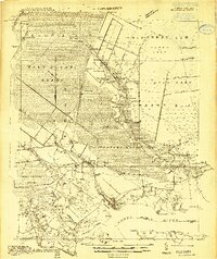
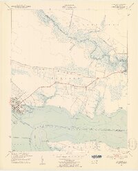
1914 Map of Belhaven
USGS Topo · Published 1914About this map
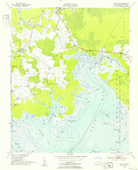
The town of Belhaven stands at the confluence of Pungo Creek and the Pungo River, serving as a vital focal point for the timber and agricultural industries of eastern North Carolina in the early 20th century. This area is characterized by an extensive network of waterways and reclaimed lands, where the Main Canal and various other drainage projects attempt to manage the West Dismal Swamp and Pantego Swamp. The presence of the John L. Roper Lumber Co. Tram and the Norfolk Southern line through Wilkinson and Pantego highlights the era's reliance on rail to move raw materials from the interior to the coast.
Find a feature on this map
83 named features on this map. Tap any name to fly to it.
Don’t see what you’re looking for? This feature index may not catch every label — zoom into the map to look around manually.
Map Details
Editions of this 1914 Belhaven Map
This is the sole edition of this map. No revisions or reprints were ever made.
Other maps of this area
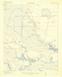
1916 · Belhaven
USGS Topo · 1:62,500

1943 · Columbia
USGS Topo · 1:125,000

1943 · Plymouth
USGS Topo · 1:125,000
1950 · Pinetown
USGS Topo · 1:24,000
1951 · Bath
USGS Topo · 1:24,000
1951 · Ransomville
USGS Topo · 1:24,000
1951 · Pamlico Beach
USGS Topo · 1:24,000
1951 · Belhaven
USGS Topo · 1:24,000
1951 · Pantego
USGS Topo · 1:24,000
1951 · Scranton
USGS Topo · 1:24,000