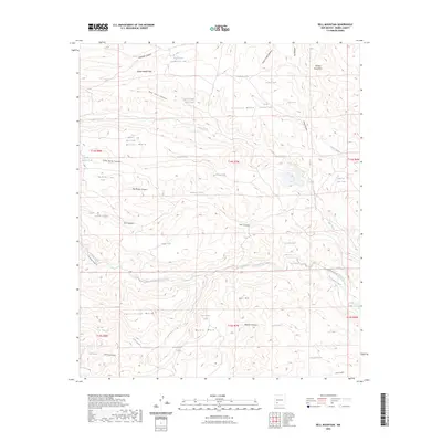
2023 Map of Bell Mountain
USGS Topo · Published 2023About this map
Bell Mtn stands at the center of this high-desert landscape in Sierra County, where an intricate network of tanks and springs supports the cattle-ranching operations of the Black Range foothills. The map reveals a complex system of livestock infrastructure, including Artesia Tank, Mike Tank, and South Johnson Tank, which are essential to the arid economy of the region. The drainage of Las Animas Creek cuts through the southern portion of the quadrangle, flanked by prominent landforms like Myers Mesa and Cave Creek Mesa. In the north, the terrain rises toward South Salado Peak and the Salado Mountains. This modern survey documents the continued use of remote routes such as Ladder Ranch Rd, providing a detailed look at the geography of these western rangelands where water sources like Bodine Spring dictate the patterns of human activity.
Find a feature on this map
54 named features on this map. Tap any name to fly to it.
Don’t see what you’re looking for? This feature index may not catch every label — zoom into the map to look around manually.
Map Details
Editions of this 2023 Bell Mountain Map
This is the sole edition of this map. No revisions or reprints were ever made.
Other maps of this area

1935 · Hillsboro
USGS Topo · 1:48,000

1940 · Hillsboro
USGS Topo · 1:62,500

1954 · Tularosa
USGS Topo · 1:250,000

1955 · Las Cruces
USGS Topo · 1:250,000

1958 · Las Cruces
USGS Topo · 1:250,000

1958 · Tularosa
USGS Topo · 1:250,000

1961 · Skute Stone Arroyo
USGS Topo · 1:24,000

1961 · Saladone Tank
USGS Topo · 1:24,000

1961 · Williamsburg NW
USGS Topo · 1:24,000

1963 · Bell Mountain
USGS Topo · 1:24,000