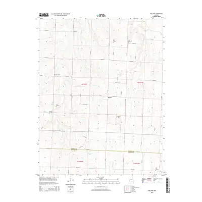
2015 Map of Bellamy
USGS Topo · Published 2015About this map
Bellamy and Rousertown anchor this rural landscape in southwestern Missouri, where the Vernon and Barton county lines meet along NE 100th Rd. The area is defined by a dense network of country roads and local creeks, including the winding Clear Cr and McCarty Cr, which drain the open agricultural fields. Genealogists will find this particular survey exceptionally valuable for its mapping of numerous small burial grounds, such as Olive Branch Cemetery, Arbor Grove Cemetery, and Tolson Cemetery, many of which are tucked away from the main thoroughfares. Near the southern boundary, the waters of Blanchards Lake sit just north of the county divide. The arrangement of the landscape highlights a persistent pattern of small-scale rural settlements and family-named landmarks that have characterized this part of the state for generations.
Find a feature on this map
58 named features on this map. Tap any name to fly to it.
Don’t see what you’re looking for? This feature index may not catch every label — zoom into the map to look around manually.
Map Details
Editions of this 2015 Bellamy Map
This is the sole edition of this map. No revisions or reprints were ever made.
Other maps of this area

1886 · Nevada
USGS Topo · 1:125,000

1894 · Nevada
USGS Topo · 1:125,000

1933 · Camp Clark
USGS Topo · 1:24,000

1939 · Dederick
USGS Topo · 1:24,000

1939 · Eldorado Springs South
USGS Topo · 1:24,000
1942 · Dederick
USGS Topo · 1:24,000
1942 · Eldorado Springs South
USGS Topo · 1:24,000

1947 · Joplin
USGS Topo · 1:250,000
1948 · Nevada
USGS Topo · 1:24,000

1949 · Joplin
USGS Topo · 1:250,000