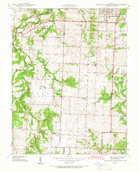
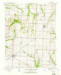
1939 Map of Eldorado Springs South
USGS Topo · Published 1966About this map
Eldorado Springs anchors the northeast corner of this Missouri landscape, while the settlement of Virgil City sits near the border of Vernon Co and Cedar Co. The geography is defined by a dense network of rural infrastructure, where schoolhouses and churches served as the primary social hubs for scattered farming families. This era of local education is visible through numerous institutions like Nine Wonders Sch, Keck Sch, and Oak Grove Sch, many of which were located at rural crossroads.
Find a feature on this map
38 named features on this map. Tap any name to fly to it.
Don’t see what you’re looking for? This feature index may not catch every label — zoom into the map to look around manually.
Map Details
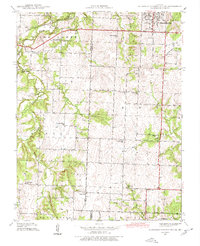
Editions of this 1939 Eldorado Springs South Map
2 editions found
Other maps of this area

1886 · Nevada
USGS Topo · 1:125,000

1886 · Stockton
USGS Topo · 1:125,000

1894 · Nevada
USGS Topo · 1:125,000

1937 · Tiffin
USGS Topo · 1:31,680
1939 · Dederick
USGS Topo · 1:24,000
1939 · Eldorado Springs North
USGS Topo · 1:24,000
1939 · Harwood
USGS Topo · 1:24,000
1939 · Filley
USGS Topo · 1:24,000
1940 · Harwood
USGS Topo · 1:24,000
1940 · Filley
USGS Topo · 1:24,000