
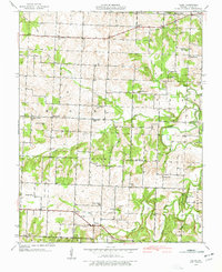
1939 Map of Filley
USGS Topo · Published 1966About this map
Filley serves as a central point in this rural landscape of southwestern Missouri, surveyed just before the 1940s. The area is defined by a dense network of country schools and churches that anchored these farming communities, including Cherry Valley Sch, Gordon Sch, and Concord Ch. The terrain is deeply carved by the winding course of Cedar Creek and its many tributaries, such as Little Alder Creek and Cherry Creek. A significant concentration of family and community burial grounds, such as Vandenburg Cem and Pleasant Ridge Cem, provides a detailed record of local genealogy. The presence of Ivy Bridge over the river and landmarks like Smith Bluff highlight the physical challenges and essential crossings that shaped travel through Cedar County during this era.
Find a feature on this map
39 named features on this map. Tap any name to fly to it.
Don’t see what you’re looking for? This feature index may not catch every label — zoom into the map to look around manually.
Map Details
Editions of this 1939 Filley Map
2 editions found
Other maps of this area

1886 · Nevada
USGS Topo · 1:125,000

1886 · Stockton
USGS Topo · 1:125,000

1894 · Nevada
USGS Topo · 1:125,000

1937 · Tiffin
USGS Topo · 1:31,680

1938 · Roscoe
USGS Topo · 1:24,000

1939 · Caplinger Mills
USGS Topo · 1:24,000

1939 · Eldorado Springs North
USGS Topo · 1:24,000

1939 · Eldorado Springs South
USGS Topo · 1:24,000

1940 · Roscoe
USGS Topo · 1:24,000

1940 · Filley
USGS Topo · 1:24,000