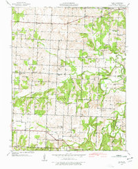
1939 Map of Filley
USGS Topo · Published 1977About this map
The small settlements of Filley and Cedar Springs anchor this 1939 survey of Cedar County, Missouri. The landscape is defined by the winding paths of Cedar Creek, Alder Creek, and Horse Creek, which separate the undulating hills of the region. This era shows a densely populated rural landscape where nearly every section supports its own schoolhouse or house of worship. Genealogists will find a wealth of family-named landmarks and local burial grounds, such as Vandenburg Cem, Malcoln Cem, and Eslinger Cem. The presence of numerous educational facilities like Wright Sch and Johnson Sch, alongside community hubs like Hazel Dell Ch, illustrates the decentralized social structure of the Missouri Ozarks before the mid-century trend toward school consolidation and rural depopulation changed the character of these townships.
Find a feature on this map
38 named features on this map. Tap any name to fly to it.
Don’t see what you’re looking for? This feature index may not catch every label — zoom into the map to look around manually.
Map Details
Editions of this 1939 Filley Map
2 editions found
Other maps of this area

1886 · Nevada
USGS Topo · 1:125,000

1886 · Stockton
USGS Topo · 1:125,000

1894 · Nevada
USGS Topo · 1:125,000

1937 · Tiffin
USGS Topo · 1:31,680

1938 · Roscoe
USGS Topo · 1:24,000

1939 · Caplinger Mills
USGS Topo · 1:24,000

1939 · Eldorado Springs North
USGS Topo · 1:24,000

1939 · Filley
USGS Topo · 1:24,000

1939 · Eldorado Springs South
USGS Topo · 1:24,000

1940 · Roscoe
USGS Topo · 1:24,000