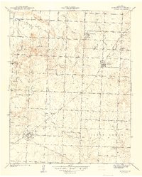
1940 Map of Harwood
USGS Topo · Published 1940About this map
The Missouri Kansas Texas railroad serves as the industrial spine for this western Missouri landscape, connecting the agricultural hubs of Walker and Harwood. Surveyed just before the 1940s, the map reveals a rural community densely organized around local schoolhouses and small settlements like Fair Haven and Handley. Education and faith are central to the geography here, with numerous landmarks including Blue Mound Sch, Coal Creek Sch, Moss Sch, and the Mt Vernon Ch dotting the countryside.
Find a feature on this map
29 named features on this map. Tap any name to fly to it.
Don’t see what you’re looking for? This feature index may not catch every label — zoom into the map to look around manually.
Map Details
Editions of this 1940 Harwood Map
This is the sole edition of this map. No revisions or reprints were ever made.
Other maps of this area

1886 · Nevada
USGS Topo · 1:125,000

1887 · Butler
USGS Topo · 1:125,000

1894 · Butler
USGS Topo · 1:125,000

1894 · Nevada
USGS Topo · 1:125,000

1933 · Camp Clark
USGS Topo · 1:24,000

1934 · Papinsville
USGS Topo · 1:24,000

1934 · Rockville
USGS Topo · 1:24,000

1936 · Rich Hill
USGS Topo · 1:24,000

1938 · Horton
USGS Topo · 1:24,000

1939 · Horton
USGS Topo · 1:24,000