
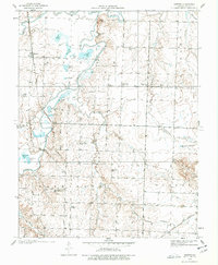
1938 Map of Horton
USGS Topo · Published 1966About this map
The confluence of the Little Osage River and the Marmaton River anchors this landscape in Vernon County, Missouri, just before the outbreak of World War II. The terrain is defined by its complex network of oxbow lakes and branches, including Stearns Lake, Cottonwood Lake, and Horseshoe Lake, which suggest a seasonal floodplain landscape that dictated the placement of early settlements. The village of Horton serves as a focal point along the Missouri Pacific tracks, while the surrounding rural landscape is dotted with essential community markers like Timber Hill School and the Ellis Cem.
Find a feature on this map
60 named features on this map. Tap any name to fly to it.
Don’t see what you’re looking for? This feature index may not catch every label — zoom into the map to look around manually.
Map Details
Editions of this 1938 Horton Map
2 editions found
Other maps of this area

1886 · Nevada
USGS Topo · 1:125,000

1887 · Butler
USGS Topo · 1:125,000

1894 · Butler
USGS Topo · 1:125,000

1894 · Nevada
USGS Topo · 1:125,000

1933 · Camp Clark
USGS Topo · 1:24,000

1934 · Papinsville
USGS Topo · 1:24,000

1936 · Rich Hill
USGS Topo · 1:24,000

1938 · Metz
USGS Topo · 1:24,000

1939 · Metz
USGS Topo · 1:24,000

1939 · Horton
USGS Topo · 1:24,000